![]()
Mt Redoubt: South Route
Fraser Valley Regional District County, British Columbia
Uploaded by Bivy Team
18 :50 hrs
8.5 mi
6300 ft
I
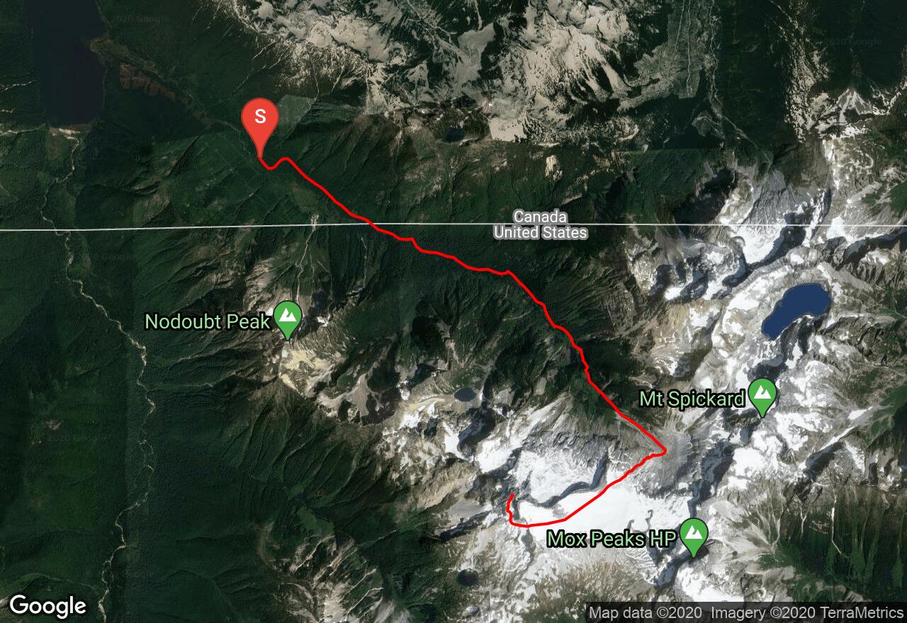
Mt Redoubt is the second highest point in the Chilliwack Group of peaks located just south of the U.S.-Canada border. The primary trailhead is located in Canada at the end of a long, pothole-ridden road. It's important to obtain camping permits from North Cascades National Park before leaving and to note that, if coming from the U.S., you should declare your intention to re-cross into Washington on the Depot Creek route. The route starts as a logging road then turns into a seldom-maintained trail that leads up the valley of Depot Creek to Depot Creek Falls, a truly spectacular cascade considered to be among the very best in the state. A fixed rope along the slippery rock at the base of the falls aids the climbing there. At the top of the falls is a wide, swampy basin with extensive talus slopes on the left side. Follow these rocky areas to Ouzel Lake, formed from glacial meltwater and a good place to camp. The route to the south side of the mountain weaves through cliff bands to reach the northern edge of the Redoubt Glacier. The lower section is heavily crevassed, even in spring, so you might have to travel along its base until you can find somewhere to cross onto it without landing in a crevasse field. Climb up the low-angle glacier to a gap in the South "Flying" Buttress and descend into the south basin. Traverse to a gully on its west edge and climb left onto a second, higher snow/scree slope due south of the summit. A gully leads steeply (Class 3-4) up to the ridge just west of the summit about 50 feet below it. Scramble along the ridge to the summit and enjoy the spectacular views. The rock on the mountain is somewhat chossy, but many parties go unroped except when on the glacier.
2 photos
[{"url":"https://images.bivy.com/lgMap/623006.jpg"},{"url":"https://images.bivy.com/lgTrailMap/623006.jpg"}]
Mt Redoubt: South Route | Fraser Valley Regional District County, British Columbia
Mt Redoubt is the second highest point in the Chilliwack Group of peaks located just south of the U.S.-Canada border. The primary trailhead is located in Canada at the end of a long, pothole-ridden road. It's important to obtain camping permits from North Cascades National Park before leaving and to note that, if coming from the U.S., you should declare your intention to re-cross into Washington on the Depot Creek route. The route starts as a logging road then turns into a seldom-maintained trail that leads up the valley of Depot Creek to Depot Creek Falls, a truly spectacular cascade considered to be among the very best in the state. A fixed rope along the slippery rock at the base of the falls aids the climbing there. At the top of the falls is a wide, swampy basin with extensive talus slopes on the left side. Follow these rocky areas to Ouzel Lake, formed from glacial meltwater and a good place to camp. The route to the south side of the mountain weaves through cliff bands to reach the northern edge of the Redoubt Glacier. The lower section is heavily crevassed, even in spring, so you might have to travel along its base until you can find somewhere to cross onto it without landing in a crevasse field. Climb up the low-angle glacier to a gap in the South "Flying" Buttress and descend into the south basin. Traverse to a gully on its west edge and climb left onto a second, higher snow/scree slope due south of the summit. A gully leads steeply (Class 3-4) up to the ridge just west of the summit about 50 feet below it. Scramble along the ridge to the summit and enjoy the spectacular views. The rock on the mountain is somewhat chossy, but many parties go unroped except when on the glacier.